
Resultados de la búsqueda
Para más opciones de búsqueda, vea Ayuda:Búsqueda.
Si consideras que este artículo debería existir, conoces nuestros pilares, dispones de fuentes fiables y sabes indicarlas como referencias, puedes crearlo, opcionalmente usando nuestro asistente.
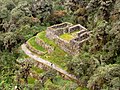 gob.pe - UGEL map of the Urubamba Province (Cusco Region) showing the location of the mountain Runkuraqay. e-travelorganizer.com Sketch map of the Inca…1 kB (84 palabras) - 18:18 18 sep 2023
 Neate, ISBN 0-89886-238-8 Batura Mustagh (sketch map and pamphlet) by Jerzy Wala, 1988. Orographical Sketch Map of the Karakoram by Jerzy Wala, 1990. Published…5 kB (525 palabras) - 16:10 16 ene 2024
 Neate, ISBN 0-89886-238-8 Batura Mustagh (sketch map and pamphlet) by Jerzy Wala, 1988. Orographical Sketch Map of the Karakoram by Jerzy Wala, 1990. Published…6 kB (667 palabras) - 21:33 8 ene 2024
 Pumahuacanca». andesinfo. Consultado el 16 de marzo de 2015. (including a sketch map) Diccionario Quechua - Español - Quechua, Academía Mayor de la Lengua…3 kB (209 palabras) - 01:21 10 oct 2023
 Jabal ar Raḩraḩ (sección Mapas y bibliografía)Walker (1958) - Sketch map drawn by Julian Walker for boundary delimitation: Ras Al Khaimah - The National Archives, London, England Map of Trucial States…7 kB (753 palabras) - 08:48 8 may 2024
 Jerzy Wala, Orographical Sketch Map of the Karakoram, Swiss Foundation for Alpine Research, 1990. Jerzy Wala, Orographical Sketch Map of the Batura Muztagh…7 kB (775 palabras) - 18:08 26 jul 2023
 Glaciares del Perú, ANA (Autoridad Nacional del Agua), Huaraz 2014 (see sketch map of the Waych'awi glaciar under 'Cordillera Huanzo') escale.minedu.gob…6 kB (185 palabras) - 15:42 29 ene 2024
 cordillera.[1] Lista de montañas más altas Jerzy Wala, Orographical Sketch Map of the Karakoram, Swiss Foundation for Alpine Research, Zurich, 1990.…2 kB (187 palabras) - 19:52 27 sep 2023
- Andes: The Return of the Living Dead, Cambridge University Press, see sketch map on p. 141 «Tumbas de Chillikupampa». mincetur. Consultado el 30 de marzo…2 kB (174 palabras) - 19:45 21 may 2023
 esos materiales. Dorsey, James Owen. (1884). [Siuslaw vocabulary, with sketch map showing villages, and incomplete key giving village names October 27,…3 kB (292 palabras) - 11:40 14 mar 2024
 occidentales de las montañas Masherbrum.[1] Jerzy Wala, Orographical Sketch Map of the Karakoram, Swiss Foundation for Alpine Research, Zurich, 1990.…2 kB (209 palabras) - 18:41 10 ene 2022
 Yinainir (sección Mapas y bibliografía)Consultado el 2 de mayo de 2024. Mindat.org - Banī ‘Udayd FCO 18/1932 - 1958- Sketch map drawn by Julian Walker for boundary delimitation: Ras Al Khaimah - The…7 kB (708 palabras) - 04:55 14 may 2024
 Global Mongabay Himalayan Index Jerzy Wala, Batura Muztagh, orographical sketch map, Gdansk, 1988. Wallner, Max (1995). «Pasu I, Sky Ascent and Descent».…3 kB (316 palabras) - 19:19 10 ene 2024
 Emirates University - 1993 Map FCO 18/1920 - 1962 - Boundaries of the Northern Trucial States: prepared and drawn from sketch maps and information supplied…8 kB (801 palabras) - 09:49 18 may 2024
 Berge der Welt 1960/61. Zürich 1961, S. 139–154. Jerzy Wala, Orographical Sketch Map of the Karakoram, Swiss Foundation for Alpine Research, Zúrich, 1990.…5 kB (500 palabras) - 00:37 27 mar 2023
 alpine-club.org.uk. Consultado el 6 de marzo de 2023. Jerzy Wala, Orographical Sketch Map of the Karakoram, Swiss Foundation for Alpine Research, Zúrich, 1990.…4 kB (311 palabras) - 15:51 3 ene 2024
 org - Baqal, Ra’s al Khaymah, United Arab Emirates FCO 18/1969 - 1959 - Sketch map drawn by Julian Walker for boundary delimitation: Dibba - The National…6 kB (686 palabras) - 01:23 14 may 2024
 7,000 metre peaks, The Mountaineers, 1989. Wala, Jerzy. Orographical Sketch Map of the Karakoram, Swiss Foundation for Alpine Research, Zúrich, 1990.…5 kB (348 palabras) - 15:43 3 ene 2024
 Ras Ash (sección Mapas y bibliografía)Walker (1958) - Sketch map drawn by Julian Walker for boundary delimitation: Ras Al Khaimah - The National Archives, London, England Map of Trucial States…5 kB (553 palabras) - 01:30 14 may 2024
 Musaibat (sección Mapas y bibliografía)Walker (1958) - Sketch map drawn by Julian Walker for boundary delimitation: Ras Al Khaimah - The National Archives, London, England Map of Trucial States…5 kB (547 palabras) - 01:28 14 may 2024


- analogous to photography; a work of applied art; an illustration, map, plan, sketch or three-dimensional work relative to geography, topography, architecture